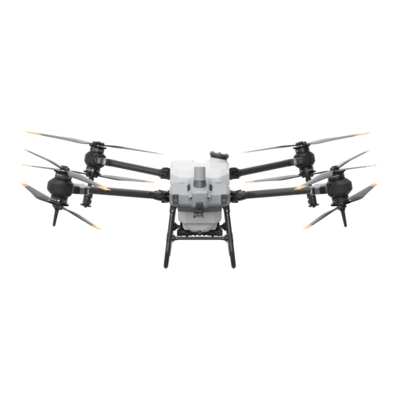
dji Agras T20P Manual de inicio rápido - Página 3
Navegue en línea o descargue pdf Manual de inicio rápido para Accesorios para drones y cuadricópteros dji Agras T20P. dji Agras T20P 15 páginas.

② In the app, go to Operation View. Tap
section.
③ Tap Start Calibration and calibration will start automatically. The result of the calibration will be displayed in the app when completed.
●Users can proceed once calibration is completed successfully.
●If calibration fails, tap "?"to view and resolve the problem. Afterwards, recalibrate and wait for successful calibration.
Flight
In the app, go to Operation View. Make sure that there is a strong GNSS signal and the system status bar indicates Ready (GNSS) or Ready
(RTK).* Otherwise, the aircraft cannot take off.
* RTK positioning is recommended. In the app, go to Operation View, tap
method for receiving RTK signals.
Takeoff
Perform a Combination Stick Command (CSC) and push the throttle stick up to take off.
OR
Landing
To land, pull down on the throttle stick to descend until the aircraft touches the ground. There are two methods to stop the motors.
Method 1: when the aircraft has landed, push and hold the throttle stick down. The motors will stop after three seconds.
Throttle Stick
Method 2: When the aircraft has landed, push the throttle stick down, and perform the same CSC that was used to start the motors. Release
both sticks once the motors have stopped. Release both sticks once the motors have stopped.
● Spinning propellers can be dangerous. Stay away from spinning propellers and motors. DO NOT start the motors in confined spaces or where
there are people nearby.
● Maintain control of the remote controller as long as the motors are running.
● DO NOT stop the motors mid-flight unless in an emergency situation where doing so will reduce the risk of damage or injury.
● It is recommended to use Method 1 to stop the motors. When using Method 2 to stop the motors, the aircraft may roll over if it is not
completely grounded. Use Method 2 with caution.
●After landing, power off the aircraft before turning off the remote controller.
Starting Operations
Users can perform aerial surveying for the operation area in the DJI Agras app. Local HD map can be generated using the offline
reconstruction function in the remote controller for field planning and route operations. DJI Agras provides multiple methods to add points.
The following descriptions use crosshair as an example.
Aerial Surveying
1. Power on the remote controller and launch the DJI Agras app.
2. Go to Operation View. Tap Mode button on the upper left corner and select Field in the Aerial Surveying panel.
3. Tap
or press R1 on the remote controller and select Crosshair in the Add Point list.
, then
, swipe down, and tap Calibration on the right of the flow meter calibration
, then RTK to enable Aircraft RTK Positioning, and select a
Throttle Stick (left stick in Mode 2)
