Garmin TREAD Panduan Pemilik - Halaman 14
Jelajahi secara online atau unduh pdf Panduan Pemilik untuk GPS Garmin TREAD. Garmin TREAD 38 halaman.
Juga untuk Garmin TREAD: Panduan Petunjuk Instalasi (14 halaman)
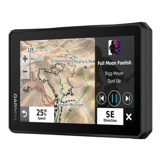
Group Ride: displays the distance and direction of the members
in your group ride
(Group Ride, page
Radio: allows you to use the push-to-talk feature with a
compatible Bluetooth headset
Headset, page
6).
Viewing a map tool
1
From the map, select
2
Select a map tool.
The map tool appears in a panel at the edge of the map.
3
When you have finished using the map tool, select
Up ahead
The Up Ahead tool provides information about upcoming
locations along your route or the road on which you are
travelling. You can view upcoming points of interest by category,
such as restaurants, fuel stations or roadside services.
You can customise the categories that show in the Up Ahead
tool.
Viewing upcoming locations
1
From the map, select
While you are travelling, the map tool shows the next location
along your road or route.
2
Select an option:
• If the map tool shows categories, select a category to view
a list of nearby locations in that category.
• If the map tool shows upcoming locations, select a
location to view location details or start a route to the
location.
Customising the up ahead categories
You can change the location categories that appear in the Up
Ahead tool.
1
From the map, select
2
Select a category.
3
Select
.
4
Select an option:
• To move a category up or down in the list, select and drag
the arrow next to the category name.
• To change a category, select the category.
• To create a custom category, select a category, select
Custom Search, and enter the name of a business or
category.
5
Select Save.
Towns Ahead
While you are travelling on a highway or navigating a route that
includes a highway, the Towns Ahead tool provides information
about upcoming towns along the highway. For each town, the
map tool shows the distance to the highway exit and the
services available, similar to the information on highway road
signs.
Viewing Upcoming Towns and Exit Services
1
From the map, select
While you are travelling along a highway or an active route,
the map tool shows information about upcoming towns and
exits.
2
Select a town.
The device shows a list of points of interest located at the
selected town exit, such as fuel stations, lodging or
restaurants.
3
Select a location, and select Go! to start navigating.
8
5).
(Enabling Push-to-Talk with a
.
> Up Ahead.
> Up Ahead.
> Towns Ahead.
Trip information
Viewing trip data from the map
Before you can view trip data on the map, you must add the tool
to the map tools menu.
From the map, select
Customising the trip data fields
1
From the map, select
2
Select a trip data field.
3
Select an option.
.
The new trip data field appears in the trip data map tool.
Viewing the trip information page
The trip information page displays your speed and provides
statistics about your trip.
From the map, select Speed.
Resetting trip information
1
From the map, select Speed.
2
Select
> Reset Field(s).
3
Select an option:
• When not navigating a route, select Select All to reset
every data field on the first page except the speedometer.
• Select Reset Overall Data to reset the information on the
trip computer.
• Select Reset Max. Speed to reset the maximum speed.
• Select Reset Trip B to reset the odometer.
Viewing Upcoming Elevation Changes
You can view upcoming elevation changes along your route.
This can help you avoid or plan for steep uphill or downhill
grades.
1
From the map, select
2
Select the chart to expand it to the full screen.
The device displays your current elevation and a chart of
elevation over distance.
3
Select an option:
• Select
• Select the arrows to scroll the chart.
Viewing upcoming traffic
Garmin is not responsible for the accuracy or timeliness of the
traffic information.
Before you can use this feature, your device must be receiving
traffic data
(Traffic, page
You can view traffic incidents coming up along your route or
along the road on which you are travelling.
1
While navigating a route, select
The nearest upcoming traffic incident appears in a panel on
the right side of the map.
2
Select the traffic incident to view additional details.
Viewing traffic on the map
The traffic map shows colour-coded traffic flow and delays on
nearby roads.
1
From the main menu, select
2
If necessary, select
traffic map.
Searching for traffic incidents
1
From the main menu, select
> Trip Data.
> Trip Data.
> Elevation.
or
to change the distance range of the chart.
NOTICE
17).
> Traffic.
> Traffic.
> Legend to view the legend for the
> Traffic.
Using the Map