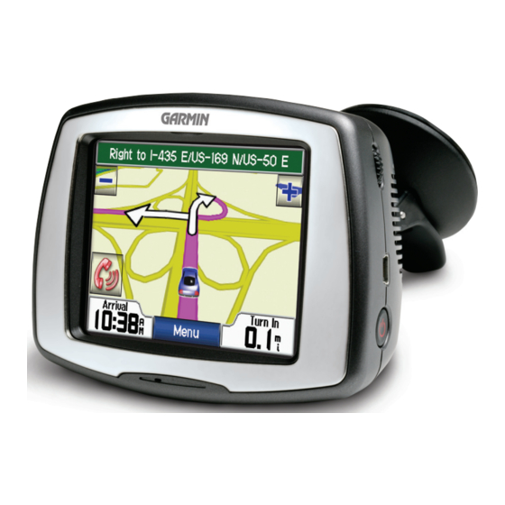
Garmin StreetPilot c550 Lembar Informasi Produk
Jelajahi secara online atau unduh pdf Lembar Informasi Produk untuk Sistem Navigasi Mobil Garmin StreetPilot c550. Garmin StreetPilot c550 2 halaman. Declaration of conformtiy
Juga untuk Garmin StreetPilot c550: Informasi Keamanan dan Produk (32 halaman), Informasi Produk (4 halaman), Pernyataan Kesesuaian (1 halaman), Fitur (2 halaman)

S
TREET
Failure to avoid the following potentially
hazardous situations could result in an accident or
collision resulting in death or serious injury.
When installing the unit in a vehicle, place the unit
securely so that it does not interfere with vehicle
operating controls or obstruct the driver's view of the
road (see diagram).
Do not mount
where driver's
field of vision
is blocked.
Do not mount in front of an
airbag field of deployment.
When navigating, carefully compare information
displayed on the unit to all available navigation
sources, including information from street signs,
visual sightings, and maps. For safety, always resolve
any discrepancies or questions before continuing
navigation.
WARNING: This product, its packaging, and its components contain chemicals known to the State of
California to cause cancer, birth defects, or reproductive harm. This Notice is being provided in accordance with
California's Proposition 65. If you have any questions or would like additional information, please refer to our
Web site at http://www.garmin.com/prop65.
Failure to avoid the following potentially
hazardous situations may result in injury or
property damage.
The unit is designed to provide you with route
suggestions. It does not reflect road closures
or road conditions, traffic congestion, weather
conditions, or other factors that may affect safety
or timing while driving.
Use the unit only as a navigational aid. Do not
attempt to use the unit for any purpose requiring
precise measurement of direction, distance,
location, or topography. This product should not
Important Information
MAP DATA INFORMATION: One of the goals of Garmin is to provide customers with the most complete
and accurate cartography that is available to us at a reasonable cost. We use a combination of governmental and
private data sources, which we identify in product literature and copyright messages displayed to the consumer.
Virtually all data sources contain inaccurate or incomplete data to some degree. This is particularly true outside
the United States, where complete and accurate digital data is either not available or prohibitively expensive.
NOTICE TO DRIVERS IN CALIFORNIA AND MINNESOTA: State law prohibits drivers in California
and Minnesota from using suction mounts on their windshields while operating motor vehicles. Other Garmin
dashboard or friction mounting options should be used. Garmin does not take any responsibility for any fines,
penalties, or damages that may be incurred as a result of disregarding this notice. (See California Vehicle Code
Section 26708(a); Minnesota Statutes 2005, Section 169.71.)
NOTICE: This Category II radiocommunication device complies with Industry Canada Standard RSS-310.
P
-S
®
ILOT
C
ERIES
unsecured
P
RODUCT
W
ARNING
Always operate the vehicle in a safe manner. Do
not become distracted by the unit while driving,
and always be fully aware of all driving conditions.
Minimize the amount of time spent viewing the
screen of the unit while driving and use voice
prompts when possible. Do not input destinations,
change settings, or access any functions requiring
prolonged use of the unit's controls while driving.
Do not
Pull over in a safe and legal manner before
place
attempting such operations.
on the
The unit contains a non-user-replaceable,
vehicle
rechargeable lithium-ion battery. The battery may
dash.
present a risk of fire or chemical burn if mistreated.
• Do not remove from the unit, heat unit above
140°F (60°C), or incinerate.
• Dispose of unit properly. Contact your local waste
disposal department for information on properly
disposing of lithium-ion batteries.
C
AUTION
be used to determine ground proximity for aircraft
navigation.
The Global Positioning System (GPS) is operated
by the United States government, which is solely
responsible for its accuracy and maintenance.
The government's system is subject to changes
which could affect the accuracy and performance
of all GPS equipment, including the unit.
Although the unit is a precision navigation
device, any navigation device can be misused or
misinterpreted and, therefore, become unsafe.
I
S
NFORMATION
HEET
