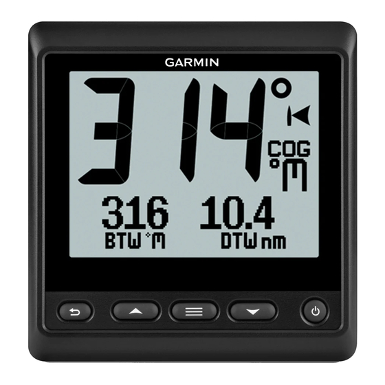
Garmin GNX 21 Panduan Pemilik - Halaman 7
Jelajahi secara online atau unduh pdf Panduan Pemilik untuk Sistem GPS Kelautan Garmin GNX 21. Garmin GNX 21 10 halaman. Gps navigation
Juga untuk Garmin GNX 21: Panduan Pemilik (10 halaman), Petunjuk Instalasi (4 halaman), Petunjuk Instalasi (4 halaman), Petunjuk Instalasi (4 halaman)

NMEA 0183 Data Type Information
Each NMEA certified sensor provides unique information to the
NMEA certified display device, such as the GNX 20/21. The
data you can view on your display depends on the sensors you
have installed and configured. See the General NMEA Data
Type Requirements topic in the Technical Reference for
Garmin ® NMEA Products manual at www.garmin.com/support.
Registering Your Device
Help us better support you by completing our online registration
today.
• Go to http://my.garmin.com.
• Keep the original sales receipt, or a photocopy, in a safe
place.
Appendix
Data Fields
ABS: Absolute, relative to another data field. For example,
absolute humidity.
AIR: The air temperature.
AVG: The average amount.
AWA: The wind angle measured relative to the bow of the
vessel.
AWS: The measured speed of the wind.
BAR: The calibrated current pressure.
BAT: The battery voltage.
BTW: The direction from your current location to a destination.
You must be navigating for this data to appear.
COG: The actual direction of travel, regardless of the course
steered and temporary variations in heading.
CTS: The direction in which you must steer to return to the
course set at the start of navigation.
DIS: The distance traveled for the current track or activity.
DPT: The depth of the water. Your device must be connected to
a NMEA 0183 or NMEA 2000 device capable of acquiring
the water depth.
DRF: The speed of the current.
DTW: The distance to the waypoint.
ELV: The altitude of your current location above or below sea
level.
ERR: The precision of the current position, when used with
GPS.
GWD: The direction of the wind relative to the ground,
referenced from the north.
GWS: The speed of the wind relative to the ground.
HDG: The direction the boat is pointing.
HUM: The level of humidity.
MAX: The maximum in relation to another data field. For
example, maximum speed.
MIN: The minimum in relation to another data field. For
example, minimum speed.
ODO: A running tally of distance traveled for all trips. This total
does not clear when resetting the trip data.
OTH: The opposite tack direction of the vessel based on the
current tack direction.
POS: The vessel's current position.
RACE: The timer for vessel racing.
REF: A steer pilot reference.
REL: Relative to another data field. For example, relative
humidity.
Appendix
RUD: The rudder relative to another data field. For example,
rudder angle.
SEA: The temperature of the water.
SOG: The actual speed of travel, regardless of the course
steered and temporary variations in heading.
STR: The steer pilot.
STW: The speed of the boat relative to the water.
TRP: A running tally of the distance traveled since the last reset.
TWA: The angle of the wind relative to the water, referenced
from the bow of the boat with a port or starboard angle up to
180 degrees.
TWD: The true direction of the wind relative to north.
TWS: The true speed of the wind relative to the vessel.
UTC: The Coordinated Universal Time.
VMG: The speed at which you are closing on a destination
along a route. You must be navigating for this data to
appear.
WND: The velocity made good upwind.
XTE: A cross track error.
3
