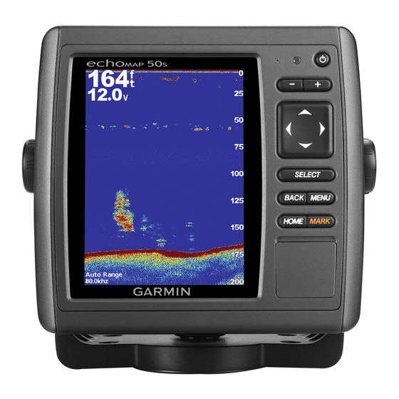
Sonar
Power: 1 kW Transducer, 1,000 W (RMS),
8,000 W (peak to peak); (1 kW transducers are supported by the
GPSMAP 525s/526s/535s/536s/545s/546s/555s/556s units only.)
Dual Frequency, 500 W (RMS), 4,000 W (peak to peak);
Dual Beam, 400 W (RMS), 3,200 W (peak to peak)
Frequency: 50/200 kHz (dual frequency and 1 kW), 80/200 kHz (dual
beam)
Depth: 2,500 ft. (762 m) (1 kW), 1,500 ft (457 m) (dual frequency),
900 ft (274 m) (dual beam) - Depth capacity is dependent on
water salinity, bottom type, and other water conditions.
Communication
NMeA 2000 PGN Information (only Applicable to NMeA 2000-compatible chartplotters):
Receive
059392
ISO Acknowledgment
059904
ISO Request
060928
ISO Address Claim
126208
NMEA - Command/Request/Acknowledge Group Function
126464
Transmit/Receive PGN List Group Function
126996
Product Information
127250
Vessel Heading
127488
Engine Parameters - Rapid Update
127489
Engine Parameters - Dynamic
127505
Fluid Level
128259
Speed - Water Referenced
128267
Water Depth
129038
AIS Class A Position Report
129039
AIS Class B Position Report
129040
AIS Class B Extended Position Report
129794
AIS Class A Static and Voyage Related Data
129799
Radio Frequency/Mode/Power
129808
DSC Call Information
130306
Wind Data
130310
Environmental Parameters
130311
Environmental Parameters (Obsolete)
130312
Temperature
130313
Humidity
130314
Actual Pressure
NMeA 0183, Version 3.01 Sentences: SDDBT, SDDPT, SDMTW, SDVHW, SDWPL
You can purchase complete information about National Marine Electronics Association (NMEA) format and sentences from:
NMEA
Seven Riggs Avenue
Severna Park, MD 21146 USA
www.nmea.org
GPSMAP 400/500 Series Installation Instructions
Transmit
059392
ISO Acknowledgment
059904
ISO Request
060928
ISO Address Claim
126208
NMEA - Command/Request/Acknowledge Group Function
126464
Transmit/Receive PGN List Group Function
126996
Product Information
127250
Water Depth
128259
Speed - Water Referenced
128267
Water Depth
129025
Position, Rapid Update
129026
COG/SOG Rapid Update
129029
GNSS - Position Data
129283
Cross Track Error
129284
Navigation Data
129285
Navigation - Route/WP information
129539
GNSS DOPs
129540
GNSS Sats in View
130306
Wind Data
Compatible GPSMAP 400/500 series chartplotters
are NMEA 2000 certified.
11

