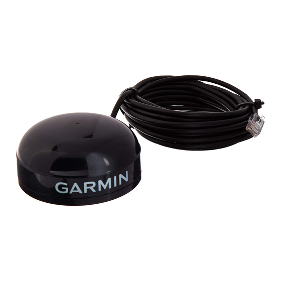
1.4 Overview
The GPS 16/17 series products are complete GPS sensors including embedded receiver and antenna,
designed for a broad spectrum of OEM (Original Equipment Manufacture) system applications. Based on
the proven technology found in other Garmin 12-channel GPS receivers, the GPS 16/17 tracks up to 12
satellites at a time while providing fast time-to-first-fix, one-second navigation updates, and low power
consumption. This generation of GPS sensors adds the capability of FAA Wide Area Augmentation System
(WAAS) differential GPS. The GPS 16/17's far-reaching capability meets the sensitivity requirements of
land navigation as well as the dynamics requirements of high-performance aircraft.
The GPS 16/17 design uses the latest technology and high-level circuit integration to achieve superior
performance while minimizing space and power requirements. All critical components of the system
including the RF/IF receiver hardware and the digital baseband are designed and manufactured by Garmin
to ensure the quality and capability of the GPS. The hardware capability combined with software
intelligence makes the GPS 16/17 easy to integrate and use.
The GPS 16/17 series products are designed to withstand rugged operating conditions and are waterproof to
IEC 60529 IPX7, immersion in 1 meter of water for 30 minutes. These complete GPS receivers require
minimal additional components to be supplied by an OEM or system integrator. A minimum system must
provide the GPS with a source of power and a clear view of the GPS satellites. The system may
communicate with the GPS via two full-duplex communication channels. Internal FLASH memory allows
the GPS to retain critical data such as satellite orbital parameters, last-known position, date and time. End
user interfaces such as keyboards and displays are the responsibility of the application designer.
Note: Due to parts availability, the GPS 17N has been replaced by the GPS 17HVS. References to the GPS
17N are for current GPS 17N product information.
Note: The GPS 16A has been discontinued. References to the GPS 16A are for current GPS 16A product
information. A comparable replacement sensor is the GPS 18-5Hz.
1.5 Features
•
12-channel GPS receiver tracks and uses up to 12 satellites for fast, accurate positioning and low
power consumption.
•
Differential DGPS capability using real-time
position accuracy (see Section
•
Compact, rugged design ideal for applications with minimal space.
•
May be remotely mounted in an out-of-the-way location.
•
Receiver position information can be displayed directly on a chartplotter or PC.
•
User initialization is not required. Once the unit is installed and has established a location fix, the unit
automatically produces navigation data.
•
User-configurable navigation mode (2-dimensional or 3-dimensional fix).
•
(Not Available on GPS 16A or GPS 17N) Highly accurate one-pulse-per-second (PPS) output for
precise timing measurements. Pulse width is configurable in 20 millisecond increments from 20 ms to
980 ms with 1 µs accuracy.
•
Configurable for binary format carrier phase data output on COM 1 port.
•
Flexible input voltage levels of 3.3 VDC to 6.0 VDC with over-voltage protection in the GPS 16LVS;
6.0 VDC to 40 VDC in the GPS 16HVS and GPS 17HVS; and 8.0 VDC to 40 VDC in the
GPS 16A and 17N.
•
FLASH-based program and non-volatile memory. New software revisions available through Web site
download. Non-volatile memory does not require battery backup.
•
Waterproof design allows continuous exposure to the prevailing weather conditions at most locations.
190-00228-20
WAAS
or RTCM corrections yielding 3 to 5 meter
1.7 Technical
Specifications).
GPS 16/17 Technical Specifications
Page 3
Rev. C

