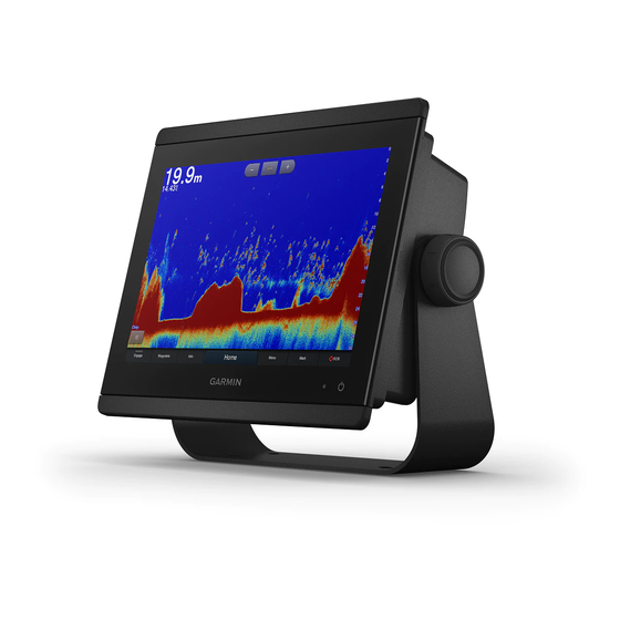
Garmin GPSMAP 8600 series Installation Instructions Manual - Page 6
Browse online or download pdf Installation Instructions Manual for Car Navigation system Garmin GPSMAP 8600 series. Garmin GPSMAP 8600 series 9 pages.
Also for Garmin GPSMAP 8600 series: Installation Instructions Manual (9 pages), Quick Start Manual (6 pages)

three NMEA 0183 devices in parallel to the Tx port to receive
data output by this chartplotter.
• See the NMEA 0183 device installation instructions to identify
the transmit (Tx) and receive (Rx) wires.
• You must use 28 AWG, shielded, twisted-pair wiring for
extended runs of wire. Solder all connections and seal them
with heat-shrink tubing.
• Do not connect the NMEA 0183 data wires from this device
to power ground.
• The power cable from the chartplotter and the NMEA 0183
devices must be connected to a common power ground.
• The internal NMEA 0183 ports and communication protocols
are configured on the chartplotter. See the NMEA 0183
section of the chartplotter owner's manual for more
information.
• See the chartplotter owner's manual for a list of the approved
NMEA 0183 sentences that the chartplotter supports.
Specifications
Device
Specification
All models
Temperature range
Material
1
Water rating
Input voltage
Fuse
NMEA 2000 LEN
NMEA 2000 draw
Max. waypoints
Max. routes
Max. active track points 50,000 points, 50 saved
Memory card
Wireless frequency and
protocols
HTML integration
10-inch
Dimensions (W × H ×
models
D)
Display size (W × H)
Weight
Clearance behind flush-
mounted device
Compass-safe distance 45 cm (17.7 in.)
Max. power usage at
10 Vdc
Typical current draw at
12 Vdc
Max. current draw at
12 Vdc
12-inch
Dimensions (W × H ×
models
D)
Display size (W × H)
Weight
Clearance behind flush-
mounted device
Compass-safe distance 35 cm (13.8 in.)
Max. power usage at
10 Vdc
6
Measurement
From -15° to 55°C (from 5° to
131°F)
Polycarbonate plastic and die-
cast aluminum
IEC 60529 IPX7
From 10 to 32 Vdc
10 A, 125 V fast-acting
2
75 mA max.
5,000
100 (250 waypoints each)
tracks
2 microSD card slots in the
back of the device; 32 GB
max. card size
Wi‑Fi
and ANT
technologies
®
®
2.4 GHz @ 12.3 dBm nominal
Compatible with OneHelm
™
integration
259.9 × 205.1 × 75.1 mm
1
1
15
(10
/
× 8
/
× 2
/
in.)
4
16
16
3
136.9 × 218.4 mm (5
/
×
8
5
8
/
in.)
8
2.4 kg (5.2 lb.)
3
11.1 cm (4
/
in.)
8
40.1 W
1.5 A
6.0 A
302.8 × x 216.4 × 75.1 mm
15
1
15
(11
/
× 8
/
× 2
/
in.)
16
2
16
1
257.3 × 145.2 mm (10
/
×
8
11
5
/
in.)
16
2.7 kg (6.0 lb.)
3
11.1 cm (4
/
in.)
8
45 W
Device
Specification
Typical current draw at
12 Vdc
Max. current draw at
12 Vdc
16-inch
Dimensions (W × H ×
models
D)
Display size (W × H)
Weight
Clearance behind flush-
mounted device
Compass-safe distance 105 cm (41.3 in.)
Max. power usage at
10 Vdc
Typical current draw at
12 Vdc
Max. current draw at
12 Vdc
2
Sonar models Frequencies
Transmit power (RMS)
4
Depth
1
The device withstands incidental exposure to water of up to 1 m
for up to 30 min. For more information, go to
/waterrating.
2
Dependent upon the transducer.
3
Dependent upon the transducer rating and depth.
4
Dependent upon the transducer, water salinity, bottom type,
and other water conditions.
NMEA 2000 PGN Information
Transmit and Receive
PGN
Description
059392
ISO acknowledgment
059904
ISO request
060160
ISO transport protocol: Data transfer
060416
ISO transport protocol: Connection management
060928
ISO address claimed
065240
Commanded address
126208
Request group function
126996
Product information
126998
Configuration information
127237
Heading/track control
127245
Rudder
127250
Vessel heading
127258
Magnetic variance
127488
Engine parameters: Rapid update
127489
Engine parameters: Dynamic
127493
Transmission parameters: Dynamic
127505
Fluid level
127508
Battery status
128259
Speed: Water referenced
Measurement
1.3 A
6.0 A
384.7 × 262.6 × 75.1 mm
1
5
15
(15
× 10
× 2
/
in.)
8
16
16
9
345.2 × 194.6 mm (13
/
×
16
11
7
/
in.)
16
4.4 kg (9.6 lb.)
3
11.1 cm (4
/
in.)
8
52.1 W
1.3 A
6.0 A
Traditional: 50/200, 77/200,
83/200 kHz
Single Channel CHIRP: from
40 to 240 kHz
Garmin ClearVü CHIRP:
260/455/800 kHz
Ultra High-Definition SideVü :
1,200 kHz, CHIRP range:
1,060 to 1,170 kHz
(dependent on transducer)
3
CHIRP: 1000 W
Garmin ClearVü and SideVü
CHIRP: 500 W
5,000 ft. at 1 kW
www.garmin.com
