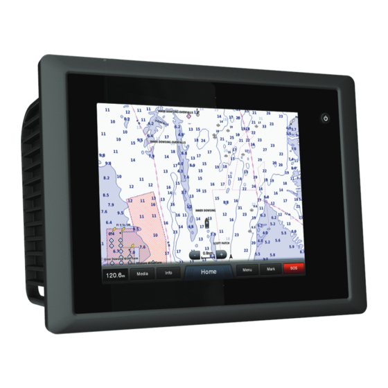
Garmin GPSMAP 8000 Glass Helm Series Instruction Manual - Page 3
Browse online or download pdf Instruction Manual for Marine Equipment Garmin GPSMAP 8000 Glass Helm Series. Garmin GPSMAP 8000 Glass Helm Series 48 pages.

Table of Contents
Introduction.................................................................... 1
GPSMAP 8000 Series Front View ............................................. 1
Using the Touchscreen ......................................................... 1
Locking the Touchscreen ...................................................... 1
Downloading the Manuals .......................................................... 1
Getting More Information ........................................................... 1
Tips and Shortcuts ..................................................................... 1
Inserting a Memory Card ........................................................... 1
Loading the New Software on a Memory Card .......................... 1
Updating the Device Software ................................................... 1
GPS Satellite Signals ................................................................. 2
Selecting the GPS Source .................................................... 2
Stations and Home Screens ...................................................... 2
Customizing the Home Screen ............................................. 2
Resetting the Station Layouts ............................................... 2
Setting the Vessel Type ............................................................. 2
Customizing the Layout of a Page ............................................. 2
Adjusting the Backlight ............................................................... 2
Adjusting the Color Mode ........................................................... 2
Charts and 3D Chart Views ........................................... 2
Navigation Chart and Offshore Fishing Chart ............................ 3
Zooming In and Out Using the Touchscreen ........................ 3
Measuring a Distance on the Chart ....................................... 3
Chart Symbols ....................................................................... 3
Showing a Different Chart ..................................................... 3
Viewing Location and Object Information on a Chart ............ 3
Viewing Details about Navaids .............................................. 3
Navigating to a Point on the Chart ........................................ 3
Premium Charts ......................................................................... 4
Viewing Tide Station Information .......................................... 4
Animated Tide and Current Indicators .............................. 4
Showing and Configuring Tides and Currents .................. 4
Showing Satellite Imagery on the Navigation Chart .............. 4
Viewing Aerial Photos of Landmarks .................................... 5
Automatic Identification System ................................................. 5
AIS Targeting Symbols ......................................................... 5
Chart View ............................................................................. 5
Activating a Target for an AIS Vessel ................................... 5
Viewing Information about a Targeted AIS Vessel ........... 5
Deactivating a Target for an AIS Vessel .......................... 6
Viewing a List of AIS and MARPA Threats ........................... 6
Setting the Safe-Zone Collision Alarm .................................. 6
AIS Distress Signals .............................................................. 6
Navigating to a Distress Signal Transmission .................. 6
AIS Distress Signal Device Targeting Symbols ................ 6
Enabling AIS Transmission Test Alerts ............................ 6
Turning Off AIS Reception .................................................... 6
Chart and 3D Chart View Settings ............................................. 6
Navigation and Fishing Chart Setup ..................................... 6
Views ..................................................................................... 7
Chart Appearance Settings ................................................... 7
Laylines Settings ................................................................... 7
Fish Eye 3D Settings ............................................................. 7
Waypoints, Routes, and Tracks.................................... 7
Waypoints .................................................................................. 7
Marking Your Present Location as a Waypoint ..................... 7
Creating a Waypoint at a Different Location ......................... 7
Marking an SOS Location ..................................................... 7
Table of Contents
Viewing a List of all Waypoints .............................................. 8
Editing a Saved Waypoint ..................................................... 8
Moving a Saved Waypoint .................................................... 8
Browsing for and Navigating to a Saved Waypoint ............... 8
Deleting a Waypoint or an MOB ............................................ 8
Deleting All Waypoints .......................................................... 8
Routes ........................................................................................ 8
Location ................................................................................. 8
Creating and Saving a Route ................................................ 8
Viewing a List of Routes ........................................................ 8
Editing a Saved Route .......................................................... 8
Browsing for and Navigating a Saved Route ........................ 9
Deleting a Saved Route ........................................................ 9
Deleting All Saved Routes .................................................... 9
Tracks ........................................................................................ 9
Showing Tracks ..................................................................... 9
Setting the Color of the Active Track ..................................... 9
Saving the Active Track ........................................................ 9
Viewing a List of Saved Tracks ............................................. 9
Editing a Saved Track ........................................................... 9
Saving a Track as a Route .................................................... 9
Browsing for and Navigating a Recorded Track .................... 9
Deleting a Saved Track ......................................................... 9
Deleting All Saved Tracks ................................................... 10
Retracing the Active Track .................................................. 10
Clearing the Active Track .................................................... 10
Managing the Track Log Memory During Recording .......... 10
Configuring the Recording Interval of the Track Log ........... 10
Deleting All Saved Waypoints, Routes, and Tracks ................. 10
Navigation with a Chartplotter.................................... 10
Basic Navigation Questions ..................................................... 10
Destinations ............................................................................. 10
Searching for a Destination by Name ................................. 10
Selecting a Destination Using the Navigation Chart ........... 10
Searching for a Marine Services Destination ...................... 11
Courses .................................................................................... 11
Setting and Following a Direct Course Using Go To ........... 11
Autopilot Navigation ............................................................ 11
Recalculating the Auto Guidance Route ........................ 11
Stopping Navigation ................................................................. 11
Sonar ............................................................................. 11
Sonar Views ............................................................................. 12
Full-Screen Sonar View ...................................................... 12
DownVü Sonar View ........................................................... 12
SideVü Sonar View ............................................................. 12
SideVü/DownVü Scanning Technology .......................... 12
Split-Zoom Sonar View ....................................................... 12
Split-Frequency Sonar View ................................................ 12
Changing the Sonar View ................................................... 12
Creating a Waypoint on the Sonar Screen .............................. 12
Viewing Sonar History .............................................................. 12
Pausing the Sonar Display ....................................................... 13
Viewing Sonar History .............................................................. 13
Sonar Sharing .......................................................................... 13
Selecting a Sonar Source ................................................... 13
Renaming a Sonar Source .................................................. 13
Adjusting the Level of Detail .................................................... 13
Adjusting the Color Intensity .................................................... 13
Adjusting the Range of the Depth or Width Scale .................... 13
Setting the Zoom Level on the Sonar Screen .......................... 13
Setting the Scroll Speed .......................................................... 14
i
