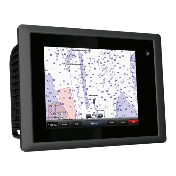
Garmin GPSMAP 8500 Black Box Gebruikershandleiding - Pagina 4
Blader online of download pdf Gebruikershandleiding voor {categorie_naam} Garmin GPSMAP 8500 Black Box. Garmin GPSMAP 8500 Black Box 36 pagina's. Quick start manual
Ook voor Garmin GPSMAP 8500 Black Box: Gebruiksaanwijzing (12 pagina's), Snelstarthandleiding (4 pagina's)

Removing a MARPA Tag from a Targeted Object ......... 13
Viewing a List of AIS and MARPA Threats ......................... 13
Showing AIS Vessels on the Radar Screen ........................ 13
VRM and EBL ..................................................................... 13
Showing the VRM and the EBL ...................................... 13
Adjusting the VRM and the EBL ..................................... 13
Radar Overlay .......................................................................... 14
Radar Overlay and Chart Data Alignment ........................... 14
Showing the Radar Overlay ................................................ 14
Stopping the Transmission of Radar Signals ........................... 14
Optimizing the Radar Display .................................................. 14
Range of Radar Signals ...................................................... 14
Radar Gain and Clutter ....................................................... 14
Manually Adjusting Gain on the Radar Screen .............. 14
Minimizing Nearby Large-Object Interference ................ 14
Minimizing Side-Lobe Interference on the Radar
Screen ............................................................................ 14
Adjusting Sea Clutter on the Radar Screen ................... 15
Adjusting Rain Clutter on the Radar Screen .................. 15
Reducing Cross Talk Clutter on the Radar Screen ........ 15
Radar Display Settings ........................................................ 15
Radar Appearance Settings ................................................ 15
Front-of-Boat Offset ............................................................ 15
Measuring the Potential Front-of-Boat Offset ................. 15
Setting the Front-of-Boat Offset ..................................... 15
Digital Selective Calling.............................................. 15
Networked Chartplotter and VHF Radio Functionality ............. 15
Turning On DSC ...................................................................... 15
DSC List ................................................................................... 16
Viewing the DSC List .......................................................... 16
Adding a DSC Contact ........................................................ 16
Incoming Distress Calls ........................................................... 16
Navigating to a Vessel in Distress ....................................... 16
Man-Overboard Distress Calls Initiated from the
Chartplotter ......................................................................... 16
Position Tracking ..................................................................... 16
Viewing a Position Report ................................................... 16
Navigating to a Tracked Vessel .......................................... 16
Editing Information in a Position Report .............................. 16
Deleting a Position-Report Call ........................................... 16
Viewing Vessel Trails on the Chart ..................................... 16
Individual Routine Calls ........................................................... 16
Selecting a DSC Channel ................................................... 16
Making an Individual Routine Call ....................................... 17
Making an Individual Routine Call to an AIS Target ............ 17
Gauges and Graphs..................................................... 17
Viewing Engine and Fuel Gauges ............................................ 17
Customizing Engine Gauge and Fuel Gauge Limits ........... 17
Enabling Status Alarms for Engine Gauges ........................ 17
Enabling Some Engine Gauge Status Alarms .................... 17
Selecting the Number of Engines Shown in Gauges .......... 17
Customizing the Engines Shown in Gauges ....................... 17
Setting the Fuel Capacity of the Vessel .............................. 17
Setting the Fuel Alarm ......................................................... 17
Viewing Trip Gauges ................................................................ 17
Resetting Trip Gauges ........................................................ 17
Viewing Graphs ........................................................................ 18
Setting the Graph Range and Time Scales ......................... 18
Tide, Current, and Celestial Information.................... 18
Tide Station Information ........................................................... 18
ii
Current Station Information ...................................................... 18
Celestial Information ................................................................ 18
Viewing Tide Station, Current Station, or Celestial Information
for a Different Date ................................................................... 18
Warning Manager ......................................................... 18
Viewing Messages ................................................................... 18
Sorting and Filtering Messages ............................................... 18
Saving Messages to a Memory Card ....................................... 18
Clearing all of the Messages .................................................... 18
Viewing Video...............................................................18
Selecting a Video Source ......................................................... 18
Alternating Among Multiple Video Sources .............................. 19
Configuring the Video Appearance .......................................... 19
Configuring the PC Display ...................................................... 19
Exiting PC Display Mode ..................................................... 19
SiriusXM™.................................................................... 19
SiriusXM Equipment and Subscription Requirements ............. 19
Weather Data Broadcasts ........................................................ 19
Changing the Weather Chart ................................................... 19
Viewing Precipitation Information ............................................. 19
Precipitation Views .............................................................. 19
Storm Cell and Lightning Information ....................................... 19
Hurricane Information .............................................................. 20
Weather Warnings and Weather Bulletins ............................... 20
Forecast Information ................................................................ 20
Weather Fronts and Pressure Centers ............................... 20
Viewing a Marine Forecast or an Offshore Forecast ........... 20
City Forecasts ..................................................................... 20
Viewing Sea Conditions ........................................................... 20
Surface Winds ..................................................................... 20
Wave Height, Wave Period, and Wave Direction ................ 21
Viewing Forecast Sea Conditions Information for Another
Time Period ......................................................................... 21
Viewing Fishing Information ..................................................... 21
Surface Pressure and Water Temperature Data ................. 21
Forecasting Fish Locations ................................................. 21
Visibility Information ................................................................. 21
Viewing Forecast Visibility Information for Another Time
Period .................................................................................. 21
Viewing Buoy Reports .............................................................. 21
Viewing Local Weather Information near a Buoy ................ 21
Creating a Waypoint on a Weather Chart ................................ 21
Weather Overlay ...................................................................... 21
Turning On the Weather Overlay on a Chart ...................... 22
Weather Overlay Settings on the Navigation Chart ............ 22
Weather Overlay Settings on the Fishing Chart .................. 22
Viewing Weather Subscription Information .............................. 22
SiriusXM Radio ........................................................................ 22
Customizing the Channel Guide ......................................... 22
Saving a SiriusXM Channel to the Presets List ................... 22
Adjusting SiriusXM Satellite Radio Volume ......................... 22
Device Configuration................................................... 22
Turning On the Chartplotter Automatically ............................... 22
System Settings ....................................................................... 22
Viewing System Software Information ................................ 22
Viewing the Event Log ........................................................ 22
Station Settings ................................................................... 22
Preferences Settings ................................................................ 22
Units Settings ...................................................................... 22
Navigation Settings ............................................................. 23
Auto Guidance Line Configurations ................................ 23
Communications Settings ....................................................... 23
Table of Contents
