Garmin GPSMAP 500 Series Instrukcja obsługi - Strona 3

Przeglądaj online lub pobierz pdf Instrukcja obsługi dla Morski system GPS Garmin GPSMAP 500 Series. Garmin GPSMAP 500 Series 38 stron. Flat-mount kit
Również dla Garmin GPSMAP 500 Series: Instrukcja obsługi (6 strony), Dodatek do podręcznika pilota (27 strony), Skrócona instrukcja obsługi (2 strony), Podręcznik referencyjny (2 strony), Instrukcja obsługi (28 strony), Szablon (2 strony), Szablon (1 strony), Podręcznik konfiguracji (2 strony), Skrócona instrukcja obsługi (4 strony), Instrukcja obsługi (44 strony), Podręcznik pilota (28 strony), Instrukcja instalacji (34 strony), Skrócona instrukcja obsługi (2 strony)
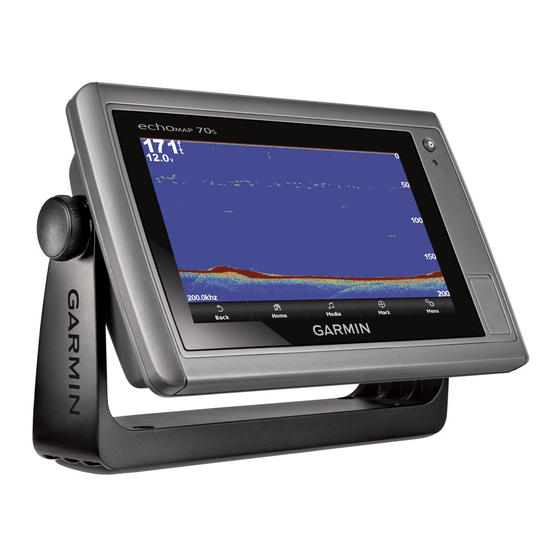
Garmin GPSMAP 500 Series Instrukcja obsługi

Table of Contents

Introduction.................................................................... 1
Device Views ............................................................................ 1
Using the Touchscreen .................................................... 1
Device Keys ..................................................................... 1
Tips and Shortcuts ..................................................................... 1
GPS Satellite Signals ................................................................. 1
Adjusting the Backlight ............................................................... 1
Adjusting the Color Mode ........................................................... 1
Customizing the Home Screen .................................................. 1
Inserting Memory Cards ............................................................. 1
Charts and 3D Chart Views ........................................... 2
Navigation Chart and Offshore Fishing Chart ............................ 2
Zooming In and Out of the Chart ........................................... 2
Panning the Chart ................................................................. 2
Chart Symbols ....................................................................... 2
Navigating to a Point on the Chart ........................................ 2
Viewing Details about Navaids .............................................. 3
Premium Charts .................................................................... 3
Viewing Tide Station Information ...................................... 3
Viewing Aerial Photos of Landmarks ................................ 4
Automatic Identification System ................................................. 4
AIS Targeting Symbols ......................................................... 4
Activating a Target for an AIS Vessel ................................... 5
Deactivating a Target for an AIS Vessel .......................... 5
Viewing a List of AIS Threats ................................................ 5
Setting the Safe-Zone Collision Alarm .................................. 5
AIS Distress Signals .............................................................. 5
Enabling AIS Transmission Test Alerts ............................ 5
Turning Off AIS Reception .................................................... 5
Chart and 3D Chart View Settings ............................................. 5
Navigation and Fishing Chart Setup ..................................... 6
Waypoints and Tracks Settings on the Charts and Chart
Views ..................................................................................... 6
Overlay Numbers Settings .................................................... 6
Editing the Data Fields ..................................................... 6
Showing a Navigation Inset ................................................... 6
Chart Appearance Settings ................................................... 6
AIS Display Settings ......................................................... 7
Fish Eye 3D Settings ............................................................. 7
Navigation with a Chartplotter...................................... 7
Basic Navigation Questions ....................................................... 7
Destinations ............................................................................... 7
Searching for a Destination by Name ................................... 7
Searching for a Destination Using Nav Info .......................... 7
Courses ...................................................................................... 8
Autopilot Navigation .............................................................. 8
Stopping Navigation ................................................................... 8
Waypoints .................................................................................. 8
Table of Contents
Viewing a List of all Waypoints .............................................. 8
Editing a Saved Waypoint ..................................................... 8
Moving a Saved Waypoint .................................................... 8
Deleting a Waypoint or an MOB ............................................ 9
Deleting All Waypoints .......................................................... 9
Routes ........................................................................................ 9
Creating and Navigating a Route From Your Present
Location ................................................................................. 9
Creating and Saving a Route ................................................ 9
Viewing a List of Routes ........................................................ 9
Editing a Saved Route .......................................................... 9
Deleting a Saved Route ...................................................... 10
Deleting All Saved Routes .................................................. 10
Tracks ...................................................................................... 10
Showing Tracks ................................................................... 10
Setting the Color of the Active Track ................................... 10
Saving the Active Track ...................................................... 10
Viewing a List of Saved Tracks ........................................... 10
Editing a Saved Track ......................................................... 10
Saving a Track as a Route .................................................. 10
Deleting a Saved Track ....................................................... 10
Deleting All Saved Tracks ................................................... 10
Retracing the Active Track .................................................. 10
Clearing the Active Track .................................................... 10
Combinations............................................................... 11
Selecting a Combination .......................................................... 11
Customizing the Combinations Screen .................................... 11
Gauges and Almanac Information.............................. 11
Viewing the Compass .............................................................. 11
Viewing Trip Gauges ................................................................ 11
Resetting Trip Gauges ........................................................ 11
Viewing Engine and Fuel Gauges ............................................ 11
Enabling Status Alarms for Engine Gauges ........................ 11
Customizing the Engines Shown in Gauges ....................... 11
Configuring the Fuel Gauges Display ................................. 11
Setting the Fuel Capacity of the Vessel .............................. 12
Setting the Fuel Alarm ......................................................... 12
Viewing the Wind Gauges ........................................................ 12
Configuring the Speed Source ............................................ 12
Viewing the Environment Gauges ............................................ 12
Configuring the Heading Source of the Environment
Gauge ................................................................................. 12
Setting the Barometer Reference Time ............................... 12
Tide, Current, and Celestial Information .................................. 12
Tide Station Information ...................................................... 12
Current Station Information ................................................. 12
Celestial Information ........................................................... 12
i