1. Introduction .................................
2. Background ................................
3. Navigating the GPS ....................
4. Flying Directly to a feature............
5. Finding the Nearest feature ........
6. Approach Planning on the GPS ...
7. Flight Plan View ...........................
8. Message Button ...........................
9. Territory Button ............................
10. Summary .....................................
1. Introduction: This document is designed for people needing basic instruction on the usage
of the GPS 500, a popular "gauge" in FSX and P3D. For beginners, just learning to "fly" can
be a challenge of practice and sometimes frustration. But once the "up and safely back down"
of flight simming is mastered, then what? Then, you GO somewhere. But the first question is
how do I get there from here? This document is a [very] BASIC starter guide. For the BEST
information on the GPS 500 go to: https://www.youtube.com/watch?v=nLVPIGoYVxs.
Flight Planning Programs: A "must" for simmers is a good Flight Planning Program. At
Return to Misty Moorings, we recommend Plan-G and VFR Flight. Both are FREEware and
both work well. You can find these at:
PLAN-G -
http://www.tasoftware.co.uk/planG.htm
•
VFR Flight -
•
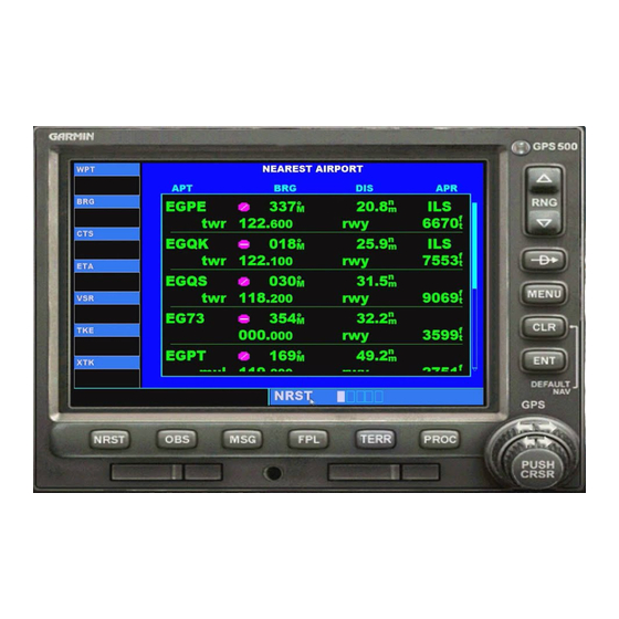
2. The GPS 500: The GPS 500 will get you from "Here to There" very efficiently. There are
parts of it that are not intuitive and many people do not use it for that reason. We will be
looking at how to use the GPS 500 in different situations. In each situation, we will give you a
step by step "how to" with screenshots so you will soon be an expert on this very useful
device.
From the Garmin Website:
https://buy.garmin.com/en-US/digital/in-the-air/discontinued/gps-500/prod115.html
GNS 500 seamlessly integrates built-in terrain and navigation databases, providing a
•
clear, concise picture of where you are and where you're heading. The 500's huge
Jeppesen® database, updated with front-loading data cards, contains location
reference for all airports, VORs, NDBs, Intersections, Flight Service Stations,
published approaches, SIDs/STARs, Special Use Airspace and geopolitical
boundaries. A detailed basemap clearly shows airports, cities, highways, railroads,
rivers, lakes, coastlines and more. Using information from the built-in terrain and U.S.
obstacles databases, the 500 displays color coding to graphically alert you when
proximity conflicts loom ahead.
1
FSX and Prepar3D – GPS 500
http://vfrflight.org/en/index.html
page 1
page 2
page 2
page 3
page 3
page 4
page 4
page 5
page 5
page 6

