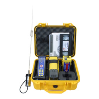
ACR Electronics VECTA 2 - REV A2 Руководство по поддержке продукта - Страница 12
Просмотреть онлайн или скачать pdf Руководство по поддержке продукта для GPS ACR Electronics VECTA 2 - REV A2. ACR Electronics VECTA 2 - REV A2 13 страниц. Dual scale direction finder

6.2
ELT False Activation
Scenario: A Cessna 172 inbound to land at the local airport bounces in on a hard landing setting
off the impact activated ELT. An old fashioned c91 ELT does not notify him that it is transmitting.
He taxis to his tie down spot, shuts down his plane and leaves, not realizing that his c91 ELT is
transmitting a signal to the COSPAS-SARSAT satellite system.
Action: The airport manager, (or ATC, FBO, Unicom, etc.) is alerted to the ELT transmission by the
AC power connected Vecta
directional antenna connector and AC power supply, unfolding the directional indicating antennas
and initiating a search of the airport grounds to identify the source of the emergency signal and
determine if indeed there is an emergency or if the signal has been set off by accident.
Within minutes they identify the Cessna, notify the owner that his ELT is falsely transmitting,
confirm the transmission via the onboard Nav-Com radio and shut off the ELT.
6.3
Hiker Rescued
Scenario: Three hikers set off for a weekend of climbing a local peak. One hiker has a 406 GPS
PLB (Personal Locator BEACON) in their emergency kit. They have properly registered it with
NOAA, told loved ones their itinerary, left a message on the dashboard of their SUV and hiked to
an altitude of 11, 420 ft. While making camp, one hiker has fallen down a deep ravine. The others
become concerned when she does not return and start a search. Night falls and there is no sign of
their companion. Out of cell phone range they activate the PLB.
Action: Within minutes, the world wide COSPAS-SARSAT satellite system picks up the GPS
signal, forwarding the information to the Local User Terminal. The Mission Control Center receives
the information from the Local User Terminal and passes the information to the local Rescue
Coordination Center. There, authorities receive the information, and using the information from the
PLB's registration, verify that this is an emergency. They then contact the local Search and Rescue
that a BEACON has been activated in their jurisdiction.
SAR maps the GPS coordinates and initiates a search. Even with the GPS coordinates, SAR opt
to use the (optional) hand held direction finding antenna for better reception in the deeply wooded
area. Getting within range, they use the 121.5 MHz homing signal with the Vecta
accuracy. Using the cross directional search pattern, SAR finds the duo and learns of the third, lost
hiker. Additional resources are called in, and within a few hours the hiker is found, with possibly life
threatening injuries. A helicopter evacuates the injured hiker and the remaining hikers continue
their journey to the summit the next day.
. Airport personnel respond by removing the Vecta
2
11
remote omni-
2
for pinpoint
2
Y1-03-0227 Rev. A2
