Garmin Alpha 100 Посібник користувача - Сторінка 3
Переглянути онлайн або завантажити pdf Посібник користувача для GPS Garmin Alpha 100. Garmin Alpha 100 24 сторінки. Multi-dog tracking gps
Також для Garmin Alpha 100: Посібник користувача (26 сторінок), Короткий довідник (2 сторінок), Інформація про продукт (4 сторінок), Посібник користувача (26 сторінок), Посібник користувача (27 сторінок), Посібник користувача (24 сторінок)
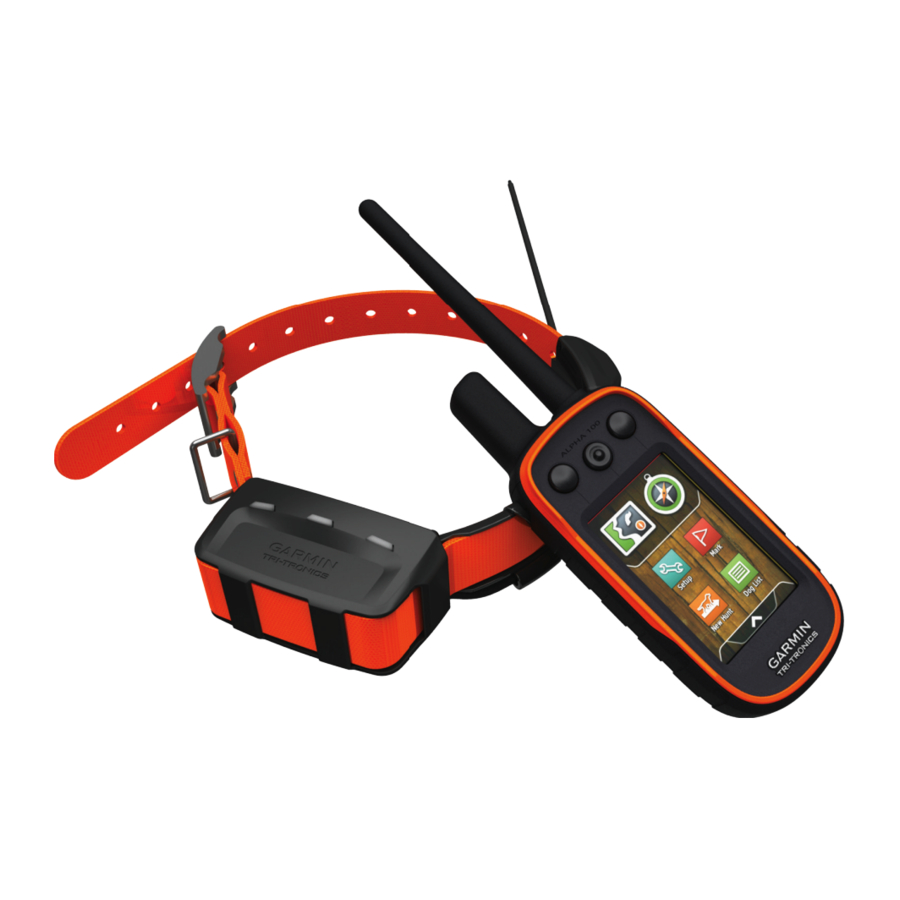
Table of Contents
Getting Started ............................................................... 1
Device Overviews ...................................................................... 1
Alpha 100 Handheld Device .................................................. 1
T5 Dog Collar Device ............................................................ 1
Getting More Information ........................................................... 1
Registering Your Device ............................................................ 1
Charging the Handheld Device .................................................. 2
Turning Off the Devices ........................................................ 2
Methods to Add a Dog Collar Device to a Handheld Device ..... 2
VHF Radio Information .......................................................... 3
Setting Dog Alerts ................................................................. 4
Removing a Dog ................................................................... 4
Dog Status Icons ........................................................................ 5
Setting a Geofence Alert ....................................................... 5
Setting a Radius Alert ........................................................... 5
Dog Training................................................................... 5
Training Methods ....................................................................... 6
Contact Tracking............................................................ 6
Adding a Contact Using MURS/VHF ......................................... 6
Initiating an Emergency Alert ..................................................... 6
Sending a Message to Your Contacts ....................................... 6
Tracking a Contact ..................................................................... 6
Finding Your Contact ID ............................................................. 6
Changing Your Contact ID ......................................................... 7
Hunting with the Alpha System.................................... 7
Table of Contents
Waypoints .................................................................................. 7
Marking a Waypoint Using the Map ...................................... 7
Editing a Waypoint ................................................................ 7
Repositioning a Waypoint to Your Current Location ............. 7
Moving a Waypoint on the Map ............................................. 7
Increasing the Accuracy of a Waypoint Location .................. 8
Deleting a Waypoint .............................................................. 8
Routes ........................................................................................ 8
Creating a Route ................................................................... 8
Editing the Name of a Route ................................................. 8
Navigating a Saved Route .................................................... 8
Editing a Route ...................................................................... 8
Reversing a Route ................................................................ 8
Viewing a Route on the Map ................................................. 8
Viewing the Active Route ...................................................... 8
Deleting a Route ................................................................... 8
Tracks ........................................................................................ 8
Viewing Details about the Track ............................................ 8
Viewing the Elevation Plot of a Track .................................... 8
Navigating to the Start of a Track .......................................... 9
Changing the Track Color ..................................................... 9
Saving the Current Track ...................................................... 9
Saving a Location on a Track ................................................ 9
Clearing the Current Track .................................................... 9
Deleting a Track .................................................................... 9
Archiving a Saved Track ....................................................... 9
Archiving Tracks Automatically ............................................. 9
Navigation.......................................................................9
Map ............................................................................................ 9
Measuring Distance on the Map ................................................ 9
Compass .................................................................................... 9
Calibrating the Compass ....................................................... 9
Navigating with the Bearing Pointer ...................................... 9
Course Pointer ...................................................................... 9
Where To? Menu ..................................................................... 10
Finding a Waypoint by Name .............................................. 10
Finding a Waypoint Near Another Waypoint ....................... 10
Navigating to a Point on the Plot ......................................... 10
Changing the Plot Type ....................................................... 10
Resetting the Elevation Plot ................................................ 10
Trip Computer .......................................................................... 10
Resetting the Trip Computer ............................................... 10
Applications................................................................. 10
Viewing the Calendar and Almanacs ....................................... 10
Changing the Satellite View ................................................ 11
Turning Off GPS .................................................................. 11
Simulating a Location .......................................................... 11
VIRB™ Remote ....................................................................... 11
i