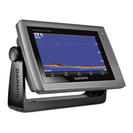
DownVü Sonar View
NOTE: Not all models support DownVü sonar technology and
transducers.
NOTE: To receive DownVü scanning sonar, you need a
compatible chartplotter or fishfinder and a compatible
transducer.
DownVü high-frequency sonar provides a clearer picture below
the boat, providing a more detailed representation of structures
the boat is passing over.
Traditional transducers emit a conical beam. The DownVü
scanning sonar technology emits a narrow beam, similar to the
shape of the beam in a copying machine. This beam provides a
clearer, picture-like image of what is beneath the boat.
SideVü Sonar View
NOTE: Not all models support SideVü sonar and scanning
transducers.
NOTE: To receive SideVü scanning sonar, you need a
compatible chartplotter, a compatible sounder module, and a
compatible transducer.
SideVü scanning sonar technology shows you a picture of what
lies to the sides of the boat. You can use this as a search tool to
find structures and fish.
Left side of the boat
Right side of the boat
The transducer on your vessel
Trees
Old tires
Logs
Distance from the side of the boat
SideVü/DownVü Scanning Technology
Instead of a more common conical beam, the SideVü/DownVü
transducer uses a flat beam to scan the water and ground to the
sides of your boat.
Split-Screen Sonar Views
The split-screen sonar views enable you to view different
combinations of sonar data simultaneously. For example, you
can view traditional sonar and DownVü sonar views in one
screen. You can edit the layout of a split-screen sonar view to
resize the window and rearrange the data.
14
The scroll rates of the traditional and DownVü sonar views are
synchronized to make the split-screen views easier to read.
Split-Zoom Sonar View
The split-zoom sonar view shows a full-view graph of sonar
readings, and a magnified portion of that graph, on the same
screen.
Split-Frequency Sonar View
In the split-frequency sonar view, one side of the screen shows
a full-view graph of high frequency sonar data, and the other
side of the screen shows a full-view graph of lower frequency
sonar data.
NOTE: The split-frequency sonar view requires the use of a
dual-frequency transducer.
Creating a Waypoint on the Sonar Screen
Using the Touchscreen
1
From a sonar view, select a location.
2
Select
.
3
If necessary, edit the waypoint information.
Creating a Waypoint on the Sonar Screen
Using the Device Keys
1
From a sonar view, use the arrow keys to select a location to
save.
2
Select SELECT.
3
If necessary, edit the waypoint information.
Measuring Distance on the Sonar Screen
You can measure the distance between two points on the
SideVü sonar view.
1
From the SideVü sonar view, select a location on the screen.
2
Select
.
A push pin appears on the screen at the selected location.
3
Select another location.
The distance and angle from the pin is listed in the upper-left
corner.
TIP: To reset the pin and measure from the current location of
the pin, select
.
Pausing the Sonar Display
From a Sonar view, select Menu > Pause Sonar.
Viewing Sonar History
You can scroll the sonar display to view historical sonar data.
1
From a sonar view, select Menu > Pause Sonar.
2
Drag the screen or use the arrow keys.
Sonar Sharing
This feature may not be available on all chartplotter models.
You can view the sonar data from other chartplotters with built-
in sonar module connected on the Garmin Marine Network.
Each chartplotter on the network can display sonar data from
every compatible sonar module and transducer on the network,
no matter where the chartplotters and transducers are mounted
on your boat. For example, from the GPSMAP 741 mounted at
the back of the boat, you can view the sonar data from an
echoMAP 70dv mounted at the front of your boat.
Chartplotters can only display sonar types they are compatible
with. For example, the echoMAP 50dv and GPSMAP 547 can
display traditional and DownVü data, but not SideVü data.
When sharing sonar data, the values of some sonar settings,
such as Range and Gain are synchronized across the devices
Sonar

