Garmin Astro 320 Посібник користувача - Сторінка 3

Переглянути онлайн або завантажити pdf Посібник користувача для Засіб для догляду за домашніми тваринами Garmin Astro 320. Garmin Astro 320 22 сторінки. Gps-enabled dog tracking system
Також для Garmin Astro 320: Посібник із швидкого старту (2 сторінок), Посібник із швидкого старту (13 сторінок), Посібник для початківців (2 сторінок), Інструкція по заміні (2 сторінок), Інструкція по заміні (2 сторінок), Декларація про відповідність (1 сторінок), Посібник із швидкого старту (6 сторінок), Посібник користувача (21 сторінок), Посібник користувача (22 сторінок), Посібник із швидкого старту (6 сторінок), Посібник користувача (22 сторінок), Посібник із швидкого старту (12 сторінок)

Garmin Astro 320 Посібник користувача

Table of Contents

Introduction.................................................................... 1
Setting Up the Astro System ...................................................... 1
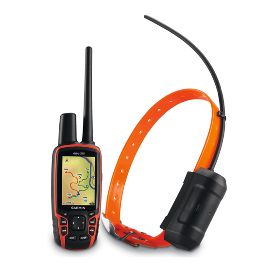
Device Overviews ...................................................................... 1
Astro 320 Handheld Device .................................................. 1
DC 50 Dog Collar Device ...................................................... 1
Keypad .................................................................................. 1
Locking the Keypad .......................................................... 1
Getting More Information ........................................................... 1
Getting the Owner's Manual .................................................. 2
Registering Your Device ....................................................... 2
Installing Batteries ...................................................................... 2
Charging the Dog Collar Device ................................................ 2
Turning On the Devices ............................................................. 2
Acquiring Satellite Signals ......................................................... 2
Adjusting the Backlight Brightness ............................................. 2
Fitting the Collar on Your Dog .................................................... 2
Using the On-Screen Keyboard ................................................. 2
Dog Tracking.................................................................. 3
Tracking Your Dog on the Map .................................................. 3
Navigating to Your Dog .............................................................. 3
Viewing Dog Status ............................................................... 3
Dog Status Icons ................................................................... 3
Dog Information ......................................................................... 3
Resetting a Dog's Statistics and Track .................................. 3
Changing the Length of the Dog's Track ............................... 3
Changing a Dog Name .......................................................... 3
Changing the Color of the Dog's Track ................................. 3
Changing the Dog Type ........................................................ 3
Setting Dog Alerts ................................................................. 3
Removing a Dog ................................................................... 3
Adding a Dog ............................................................................. 3
Assigning a Dog ID Manually ................................................ 3
About Collar Lock ....................................................................... 4
Activating Collar Lock ............................................................ 4
Communication with the Collar .................................................. 4
Tracking with BaseCamp™ BaseStation ................................... 4
Waypoints, Routes, and Tracks ................................... 4
Waypoints .................................................................................. 4
Marking Your Vehicle Location ............................................. 4
Marking Your Current Location ............................................. 4
Marking a Covey ................................................................... 4
Marking a Waypoint Using the Map ...................................... 4
Navigating to a Waypoint ...................................................... 4
Editing a Waypoint ................................................................ 4
Finding a Waypoint by Name ................................................ 4
Finding a Waypoint Near Another Waypoint ......................... 4
Moving a Waypoint on the Map ............................................. 4
Projecting a Waypoint ........................................................... 5
Deleting a Waypoint .............................................................. 5
Routes ........................................................................................ 5
Creating a Route ................................................................... 5
Navigating a Saved Route .................................................... 5
Editing a Route ...................................................................... 5
Viewing the Active Route ...................................................... 5
Reversing a Route ................................................................ 5
Deleting a Route ................................................................... 5
Deleting All Routes ................................................................ 5
Tracks ........................................................................................ 5
Recording Track Logs ........................................................... 5
Viewing the Elevation Plot of a Track .................................... 5
Viewing Details about the Track ............................................ 5
Table of Contents
Saving the Current Track ...................................................... 6
Marking a Location on a Saved Track ................................... 6
Navigating to the Start of a Track .......................................... 6
Archiving a Track Manually ................................................... 6
Archiving Tracks Automatically ....................................... 6
Sending and Receiving Data Wirelessly .................................... 6
Sharing Dog Information ....................................................... 6
Receiving Dog Information .................................................... 6
Navigation.......................................................................6
Map ............................................................................................ 6
Enabling the Map Data Fields ............................................... 6
Compass .................................................................................... 6
Calibrating the Compass ....................................................... 6
Navigating with the Bearing Pointer ...................................... 6
Course Pointer ...................................................................... 6
Find Menu .................................................................................. 7
Finding a Waypoint by Name ................................................ 7
Navigating with Sight 'N Go ....................................................... 7
Viewing the Elevation Plot ......................................................... 7
Calibrating the Barometric Altimeter ..................................... 7
Navigating to a Point on the Plot ........................................... 7
Changing the Plot Type ......................................................... 7
Trip Computer ............................................................................ 7
Resetting the Trip Computer ................................................. 7
Applications................................................................... 7
Setting a Proximity Alarm ........................................................... 7
Calculating the Size of an Area .................................................. 7
Viewing the Calendar and Almanacs ......................................... 7
Setting an Alarm ........................................................................ 7
Geocaches ................................................................................. 8
Downloading Geocaches ...................................................... 8
Finding a Geocache .............................................................. 8
Filtering the Geocache List ................................................... 8
Editing a Custom Geocache Filter .................................... 8
Creating and Saving a Geocache Filter ........................... 8
chirp™ ................................................................................... 8
Enabling chirp Searching ................................................. 8
Finding a Geocache with a chirp ...................................... 8
Opening the Stopwatch .............................................................. 8
Satellite Page ............................................................................. 8
Changing the Satellite View .................................................. 8
Turning Off GPS .................................................................... 8
Simulating a Location ............................................................ 8
Enabling Bark Detection ............................................................ 8
Enabling Rescue Mode .............................................................. 8
Customizing Your Device .............................................. 8
Customizing the Main Menu ...................................................... 8
Customizing the Data Fields ...................................................... 9
Profiles ....................................................................................... 9
Creating a Custom Profile ..................................................... 9
Editing a Profile Name .......................................................... 9
Deleting a Profile ................................................................... 9
System Settings ......................................................................... 9
Dog Settings .............................................................................. 9
Display Settings ......................................................................... 9
Setting the Device Tones ........................................................... 9
Map Settings .............................................................................. 9
Advanced Map Settings ........................................................ 9
Tracks Settings .......................................................................... 9
Changing the Units of Measure ............................................... 10
Time Settings ........................................................................... 10
Position Format Settings .......................................................... 10
Heading Settings ...................................................................... 10
Altimeter Settings ..................................................................... 10
i