Garmin GPSMAP 5208 - Marine GPS Receiver User Manual

Browse online or download pdf User Manual for Marine GPS System Garmin GPSMAP 5208 - Marine GPS Receiver. Garmin GPSMAP 5208 - Marine GPS Receiver 6 pages. Weather and xm satellite radio gpsmap 4000 series; gpsmap 5000 series; gpsmap 6000 series; gpsmap 7000 series
Also for Garmin GPSMAP 5208 - Marine GPS Receiver: Important Safety Information (4 pages), Quick Reference Manual (2 pages), Owner's Manual (2 pages), Owner's Manual (2 pages), Technical Reference (30 pages), Installation Instructions Manual (19 pages), Installation Instructions Manual (25 pages), Quick Reference Manual (2 pages), Installation Instructions Manual (25 pages), Declaration Of Conformity (1 pages), Printing Manual (2 pages), Supplement Manual (24 pages)
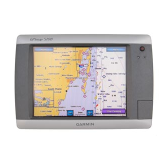
Garmin GPSMAP 5208 - Marine GPS Receiver User Manual
Garmin
®
56
Garmin panel mounted
shown with Vantage View gauges
GPSMAP® 5208 and GPSMAP® 5212 easily connects
to the high-speed Garmin Marine Network, so you
can interface with additional MFDs and add remote
sensors. You can also add high-powered radar, sonar,
and XM™ satellite weather and radio to your system.
Mix and Match with Vantage View gauges
to see Alarms, Faults and Warnings.
See page 55
®
GPSMAP
- Menu-driven touchscreen interface
- High resolution display
- Panel or bracket mount
- World wide satellite imagery
- Preloaded US marine charts including
Alaska, Hawaii and Bahamas
- NMEA2000 support for engine monitoring
- Connect to the Garmin Marine Network to
add sonar, radar and weather
GPSMAP
5208
®
- Dimensions: 10.1" W x 6.8" H x 4.2" D
- Overall: 10 3/4" W x 7 1/4" H
- Screen size: 8.4" diagonally
- Resolution 640 x 480
What you get
- GPSMAP® 5208
- Bail mount
- Power cable
- Video cable assembly
- Protective front cover
- Installation instructions
Display
010-00593-01
bezel
GPSB5208 + color
- Flush mount
- GPS 17x NMEA2000
- NMEA0183 cable
- Marine grommet kit
- Owner's manual