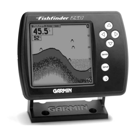
Garmin Fishfinder 240 Blue Gebruikershandleiding - Pagina 38

Blader online of download pdf Gebruikershandleiding voor {categorie_naam} Garmin Fishfinder 240 Blue. Garmin Fishfinder 240 Blue 50 pagina's. Garmin fishfinder 160 blue owner's manual
Ook voor Garmin Fishfinder 240 Blue: Gebruikershandleiding (50 pagina's), Handleiding voor piloten (12 pagina's), Specificaties (2 pagina's), Specificaties (2 pagina's), Gebruikershandleiding (50 pagina's), Gebruikershandleiding (50 pagina's)

Garmin Fishfinder 240 Blue Gebruikershandleiding
On the Water
On the Water

Understanding the Chart

Enlarged
Transducer
View
Remember that the Fishfi nder displays a 2D picture
of the underwater environment. The fi sh and tree
could be located anywhere in the coverage area at
that slice of time.
30
30
Understanding the Chart
It is important to understand that the unit does not display a 3-D repre-
sentation of the underwater environment. The unit can display multiple
things at the same time, but can not determine where the return originated
only when it was received.
Example 2 provides a look at the underwater world from a top view,
and relates that view to what would be displayed on the chart. On the chart
it appears the fi sh and tree are side by side, but when we look at the scene
from the top we can see that the fi sh is several feet from the tree. It is
important to remember that the fi shfi nder can not determine where in the
coverage area the tree or fi sh are, only that the returns were received in
Branches
the same time frame.
Fish
Branches
Enlarged
Transducer
View
Fish
Example 2.