Garmin echomap 40 series Kullanıcı El Kitabı - Sayfa 3
Deniz GPS Sistemi Garmin echomap 40 series için çevrimiçi göz atın veya pdf Kullanıcı El Kitabı indirin. Garmin echomap 40 series 50 sayfaları. Vhf comm
Ayrıca Garmin echomap 40 series için: Kurulum Talimatları Kılavuzu (15 sayfalar), Kullanıcı El Kitabı (32 sayfalar), Uygunluk Beyanı (1 sayfalar), Pilot El Kitabı (22 sayfalar), Kullanıcı El Kitabı (30 sayfalar)
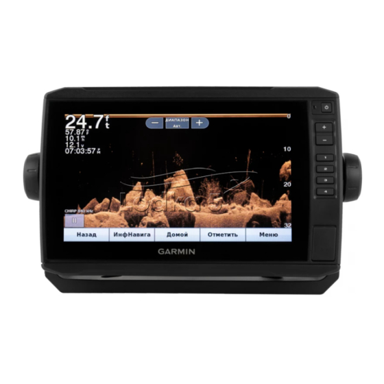
Table of Contents
Introduction.....................................................................1
ECHOMAP Plus 40 Device View ................................................ 1
Device Keys ........................................................................... 1
ECHOMAP Plus 60 Front View .................................................. 1
Device Keys ........................................................................... 1
ECHOMAP Plus 70/90 Front View ............................................. 1
Device Keys ........................................................................... 2
Assigning a Shortcut Key ....................................................... 2
Getting the Owner's Manual ....................................................... 2
Acquiring GPS Satellite Signals .................................................. 2
Selecting the GPS Source ..................................................... 2
Inserting Memory Cards ............................................................. 2
Customizing the Chartplotter........................................ 2
Customizing the Home Screen ................................................... 2
Customizing Pages ..................................................................... 2
Customizing a Combination Page .......................................... 2
70/90 ...................................................................................... 2
60 ........................................................................................... 2
40 ........................................................................................... 3
Setting the Vessel Type .............................................................. 3
Adjusting the Backlight ............................................................... 3
Adjusting the Color Mode ........................................................... 3
ActiveCaptain App ......................................................... 3
ActiveCaptain Roles ................................................................... 3
Getting Started with the ActiveCaptain App ............................... 3
Receiving Smart Notifications ..................................................... 4
Updating Software with the ActiveCaptain App .......................... 4
Updating Charts with ActiveCaptain ........................................... 4
Charts and 3D Chart Views........................................... 4
Navigation Chart and Fishing Chart ........................................... 4
Zooming In and Out of the Chart ........................................... 5
Panning the Chart with the Keys ........................................... 5
Selecting an Item on the Map Using the Device Keys ........... 5
Chart Symbols ....................................................................... 5
Measuring a Distance on the Chart ....................................... 5
Creating a Waypoint on the Chart .......................................... 5
Navigating to a Point on the Chart ......................................... 5
Viewing Location and Object Information on a Chart ............ 5
Viewing Details about Navaids .............................................. 5
Heading Line and Angle Markers .......................................... 5
Turning on Angle Markers ................................................. 6
Premium Charts .......................................................................... 6
Viewing Tide Station Information ........................................... 6
Animated Tide and Current Indicators .............................. 6
Showing Tides and Current Indicators .............................. 6
Showing Satellite Imagery on the Navigation Chart .............. 6
Viewing Aerial Photos of Landmarks ..................................... 7
Automatic Identification System .................................................. 7
AIS Targeting Symbols .......................................................... 7
Showing AIS Vessels on a Chart or 3D Chart View .............. 7
Activating a Target for an AIS Vessel .................................... 8
Viewing Information about a Targeted AIS Vessel ........... 8
Deactivating a Target for an AIS Vessel ........................... 8
Viewing a List of AIS Threats ................................................. 8
Setting the Safe-Zone Collision Alarm ................................... 8
AIS Distress Signals .............................................................. 8
Navigating to a Distress Signal Transmission ................... 8
AIS Distress Signal Device Targeting Symbols ................ 8
Table of Contents
Enabling AIS Transmission Test Alerts ............................. 8
Turning Off AIS Reception ..................................................... 8
Chart and 3D Chart View Settings .............................................. 8
Navigation and Fishing Chart Setup ...................................... 8
Chart Appearance Settings ............................................... 9
Overlay Numbers Settings ................................................ 9
Showing a Navigation Inset ............................................... 9
Views ................................................................................... 10
AIS Display Settings ........................................................ 10
Laylines Settings .................................................................. 10
Fish Eye 3D Settings ........................................................... 10
Supported Maps ....................................................................... 10
Garmin Quickdraw Contours Mapping....................... 10
Contours Feature ...................................................................... 11
Adding a Label to a Garmin Quickdraw Contours Map ............ 11
Garmin Quickdraw Community ................................................. 11
ActiveCaptain ....................................................................... 11
ActiveCaptain .................................................................. 11
Garmin Connect ................................................................... 11
Garmin Connect .............................................................. 11
Garmin Quickdraw Contours Settings ...................................... 12
Depth Range Shading ......................................................... 12
Navigation with a Chartplotter.................................... 12
Basic Navigation Questions ...................................................... 13
Destinations .............................................................................. 13
Searching for a Destination by Name .................................. 13
Selecting a Destination Using the Navigation Chart ............ 13
Searching for Destination Using User Data ......................... 13
Searching for a Marine Services Destination ....................... 13
Courses .................................................................................... 13
Setting and Following a Direct Course Using Go To ........... 13
Stopping Navigation ................................................................. 14
Waypoints ................................................................................. 14
Marking Your Present Location as a Waypoint .................... 14
Creating a Waypoint at a Different Location ........................ 14
Marking an MOB or SOS Location ....................................... 14
Viewing a List of all Waypoints ............................................ 14
Editing a Saved Waypoint .................................................... 14
Browsing for and Navigating to a Saved Waypoint .............. 14
Deleting a Waypoint or an MOB .......................................... 14
Deleting All Waypoints ......................................................... 14
Routes ...................................................................................... 14
Location ............................................................................... 14
Creating and Saving a Route ............................................... 14
Viewing a List of Routes ...................................................... 14
Editing a Saved Route ......................................................... 14
Browsing for and Navigating a Saved Route ....................... 15
Deleting a Saved Route ....................................................... 15
Deleting All Saved Routes ................................................... 15
Auto Guidance .......................................................................... 15
Setting and Following an Auto Guidance Path .................... 15
Creating an Auto Guidance Path ......................................... 15
i