Garmin echomap 40 series 소유자 매뉴얼 - 페이지 3
{카테고리_이름} Garmin echomap 40 series에 대한 소유자 매뉴얼을 온라인으로 검색하거나 PDF를 다운로드하세요. Garmin echomap 40 series 50 페이지. Vhf comm
Garmin echomap 40 series에 대해서도 마찬가지입니다: 설치 지침 매뉴얼 (15 페이지), 소유자 매뉴얼 (32 페이지), 적합성 선언 (1 페이지), 파일럿 매뉴얼 (22 페이지), 소유자 매뉴얼 (30 페이지)
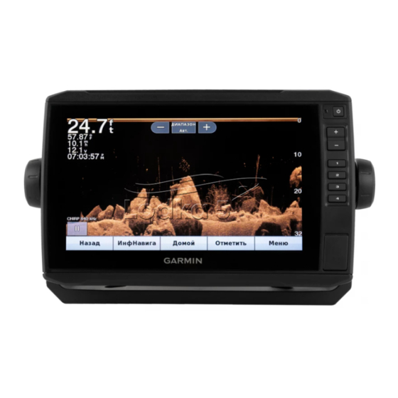
Table of Contents
Introduction.....................................................................1
ECHOMAP Plus 40 Device View ................................................ 1
Device Keys ........................................................................... 1
ECHOMAP Plus 60 Front View .................................................. 1
Device Keys ........................................................................... 1
ECHOMAP Plus 70/90 Front View ............................................. 1
Device Keys ........................................................................... 2
Assigning a Shortcut Key ....................................................... 2
Getting the Owner's Manual ....................................................... 2
Acquiring GPS Satellite Signals .................................................. 2
Selecting the GPS Source ..................................................... 2
Inserting Memory Cards ............................................................. 2
Customizing the Chartplotter........................................ 2
Customizing the Home Screen ................................................... 2
Customizing Pages ..................................................................... 2
Customizing a Combination Page .......................................... 2
70/90 ...................................................................................... 2
60 ........................................................................................... 2
40 ........................................................................................... 3
Setting the Vessel Type .............................................................. 3
Adjusting the Backlight ............................................................... 3
Adjusting the Color Mode ........................................................... 3
ActiveCaptain App ......................................................... 3
ActiveCaptain Roles ................................................................... 3
Getting Started with the ActiveCaptain App ............................... 3
Receiving Smart Notifications ..................................................... 4
Updating Software with the ActiveCaptain App .......................... 4
Updating Charts with ActiveCaptain ........................................... 4
Charts and 3D Chart Views........................................... 4
Navigation Chart and Fishing Chart ........................................... 4
Zooming In and Out of the Chart ........................................... 5
Panning the Chart with the Keys ........................................... 5
Selecting an Item on the Map Using the Device Keys ........... 5
Chart Symbols ....................................................................... 5
Measuring a Distance on the Chart ....................................... 5
Creating a Waypoint on the Chart .......................................... 5
Navigating to a Point on the Chart ......................................... 5
Viewing Location and Object Information on a Chart ............ 5
Viewing Details about Navaids .............................................. 5
Heading Line and Angle Markers .......................................... 5
Turning on Angle Markers ................................................. 6
Premium Charts .......................................................................... 6
Viewing Tide Station Information ........................................... 6
Animated Tide and Current Indicators .............................. 6
Showing Tides and Current Indicators .............................. 6
Showing Satellite Imagery on the Navigation Chart .............. 6
Viewing Aerial Photos of Landmarks ..................................... 7
Automatic Identification System .................................................. 7
AIS Targeting Symbols .......................................................... 7
Showing AIS Vessels on a Chart or 3D Chart View .............. 7
Activating a Target for an AIS Vessel .................................... 8
Viewing Information about a Targeted AIS Vessel ........... 8
Deactivating a Target for an AIS Vessel ........................... 8
Viewing a List of AIS Threats ................................................. 8
Setting the Safe-Zone Collision Alarm ................................... 8
AIS Distress Signals .............................................................. 8
Navigating to a Distress Signal Transmission ................... 8
AIS Distress Signal Device Targeting Symbols ................ 8
Table of Contents
Enabling AIS Transmission Test Alerts ............................. 8
Turning Off AIS Reception ..................................................... 8
Chart and 3D Chart View Settings .............................................. 8
Navigation and Fishing Chart Setup ...................................... 8
Chart Appearance Settings ............................................... 9
Overlay Numbers Settings ................................................ 9
Showing a Navigation Inset ............................................... 9
Views ................................................................................... 10
AIS Display Settings ........................................................ 10
Laylines Settings .................................................................. 10
Fish Eye 3D Settings ........................................................... 10
Supported Maps ....................................................................... 10
Garmin Quickdraw Contours Mapping....................... 10
Contours Feature ...................................................................... 11
Adding a Label to a Garmin Quickdraw Contours Map ............ 11
Garmin Quickdraw Community ................................................. 11
ActiveCaptain ....................................................................... 11
ActiveCaptain .................................................................. 11
Garmin Connect ................................................................... 11
Garmin Connect .............................................................. 11
Garmin Quickdraw Contours Settings ...................................... 12
Depth Range Shading ......................................................... 12
Navigation with a Chartplotter.................................... 12
Basic Navigation Questions ...................................................... 13
Destinations .............................................................................. 13
Searching for a Destination by Name .................................. 13
Selecting a Destination Using the Navigation Chart ............ 13
Searching for Destination Using User Data ......................... 13
Searching for a Marine Services Destination ....................... 13
Courses .................................................................................... 13
Setting and Following a Direct Course Using Go To ........... 13
Stopping Navigation ................................................................. 14
Waypoints ................................................................................. 14
Marking Your Present Location as a Waypoint .................... 14
Creating a Waypoint at a Different Location ........................ 14
Marking an MOB or SOS Location ....................................... 14
Viewing a List of all Waypoints ............................................ 14
Editing a Saved Waypoint .................................................... 14
Browsing for and Navigating to a Saved Waypoint .............. 14
Deleting a Waypoint or an MOB .......................................... 14
Deleting All Waypoints ......................................................... 14
Routes ...................................................................................... 14
Location ............................................................................... 14
Creating and Saving a Route ............................................... 14
Viewing a List of Routes ...................................................... 14
Editing a Saved Route ......................................................... 14
Browsing for and Navigating a Saved Route ....................... 15
Deleting a Saved Route ....................................................... 15
Deleting All Saved Routes ................................................... 15
Auto Guidance .......................................................................... 15
Setting and Following an Auto Guidance Path .................... 15
Creating an Auto Guidance Path ......................................... 15
i