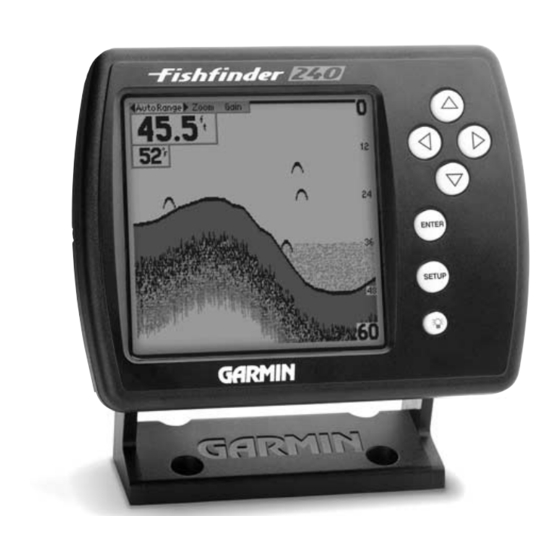
Garmin Fishfinder 240 Blue Kullanıcı El Kitabı - Sayfa 26

Deniz GPS Sistemi Garmin Fishfinder 240 Blue için çevrimiçi göz atın veya pdf Kullanıcı El Kitabı indirin. Garmin Fishfinder 240 Blue 50 sayfaları. Garmin fishfinder 160 blue owner's manual
Ayrıca Garmin Fishfinder 240 Blue için: Kullanıcı El Kitabı (50 sayfalar), Kullanıcı El Kitabı (50 sayfalar), Pilot El Kitabı (12 sayfalar), Teknik Özellikler (2 sayfalar), Teknik Özellikler (2 sayfalar), Kullanıcı El Kitabı (50 sayfalar)

Garmin Fishfinder 240 Blue Kullanıcı El Kitabı
www.reelschematic.com
Unit Operation
Setup Menu: Chart/Tools Tabs
Scale — 'Overlay'
Scale — 'Basic'
18

Scale

The depth 'Scale' can be configured to display in four different modes: as an
'Overlay,' in the 'Corners,' as a 'Basic' Scale, or with 'No Scale.'

Tools Tab

'Noise Reject' tools. The 'Depth Line' tool is used to quickly identify a set
depth or to measure the depth of underwater objects. The 'Noise Reject' and
Scale — 'Corners'
'Flasher' tools are used to enhance the chart and help in identifying and
providing information about an underwater return. The 'Simulator' tool
is used to enhance the simulator mode by allowing you to customize the
simulated transducer selection. To access the 'Tools' tab, place the highlight
over it using the arrow keys.

Depth Line

to the Adjustment Bar.
Scale — 'No Scale'
The depth 'Scale' is displayed vertically along the right side of the chart.
To change the Scale Setting:
1. Highlight the 'Chart' tab on the Setup Menu.
2. Highlight the 'Scale' selection fi eld and press ENTER.
3. Choose 'Overlay,' 'Corners,' 'Basic' or 'No Scale,' then press ENTER to
accept the selection.
The 'Tools' tab contains the 'Depth Line,' 'Flasher,' 'Simulator' and
When the 'Depth Line' tool is activated, a Depth Line selection is added
To activate the Depth Line:
1. Highlight the 'Tools' tab on the Setup Menu.
2. Highlight the 'Depth Line' selection fi eld and press ENTER.
3. Select 'On' and press ENTER.